Agios Nikolaos
Agios Nikolaos town
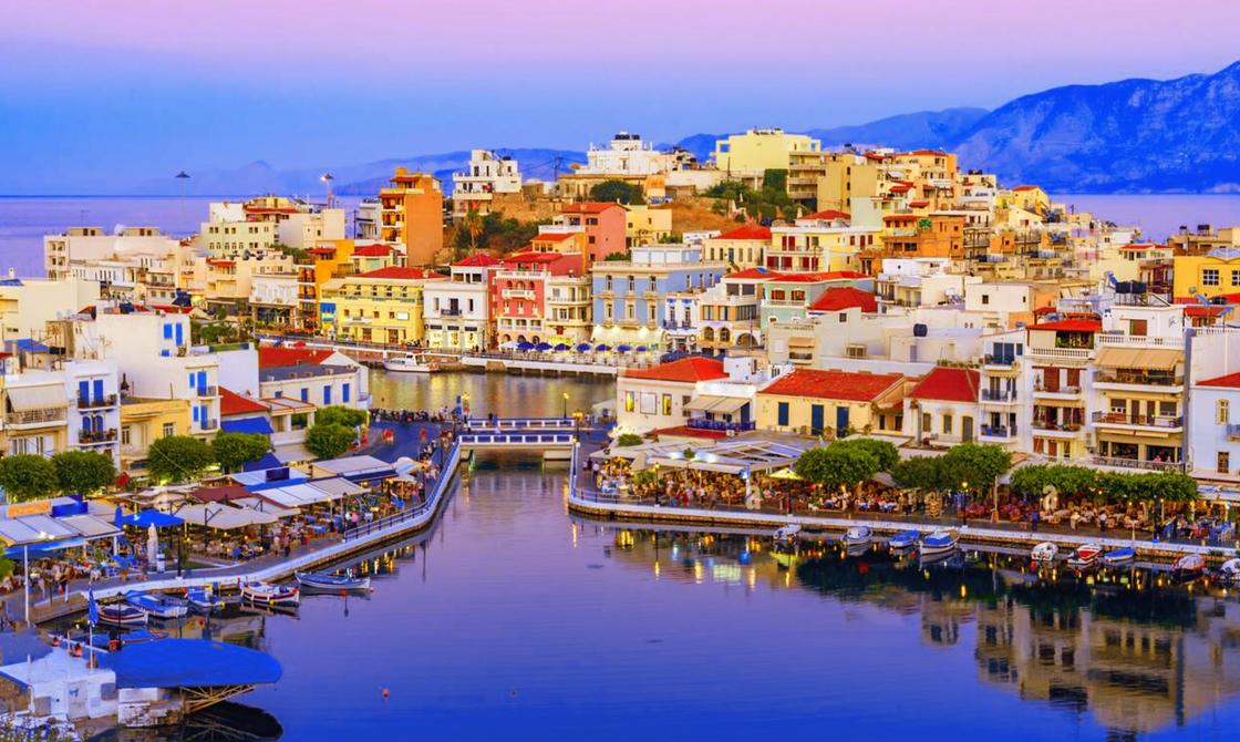
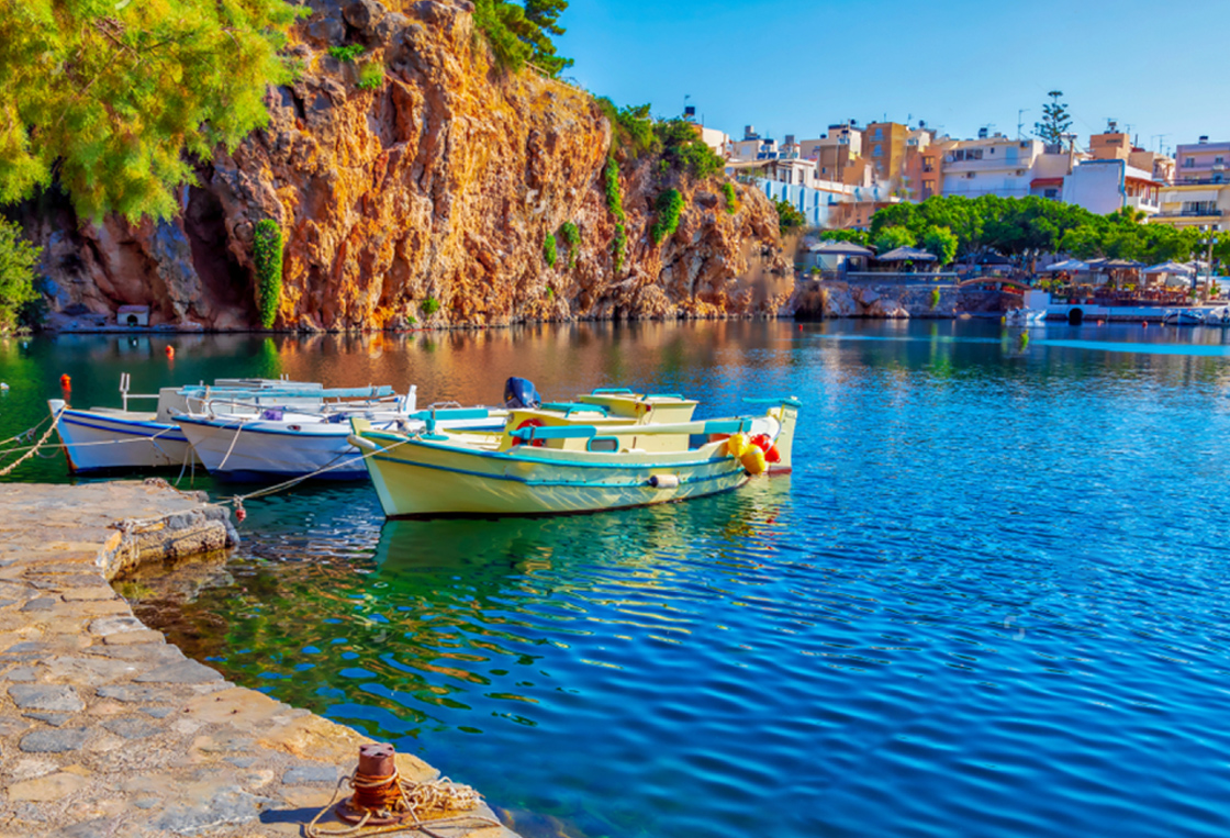
Agios Nikolaos is the cosmopolitan capital of the regional unit of Lasithi with a population of 20,000 inhabitants. Agios Nikolaos is a beautiful quiet little town built on the site of Madraki, on the western side of the large gulf of Mirabello. A hallmark of Agios Nikolaos is the picturesque Limni Voulismeni, a small lagoon in the center of the town, used to moor boats. Dozens of legends are associated with it because of its very deep waters, such as that it has no depth. A walk around the lake is a very nice experience.
Other attractions of Agios Nikolaos are the neoclassical buildings, the marina (the first marina in Crete), the island of Agion Panton with the protected Cretan goats, Kitroplateia with the taverns and the pedestrian street with the cafes. Also impressive are the stairs that are found almost everywhere, since the town is built in an area with very steep slopes. Due to the fact that the Venetians never paid much attention to the area, Agios Nikolaos was not fortified with a wall and remained a small fishing village until the time when the prefecture's capital was moved here at the beginning of the 20th century. Since then, the town has transformed into a picturesque tourist resort with its main pillars of development being its beautiful beaches, tranquility and picturesqueness.
Spinalonga Island
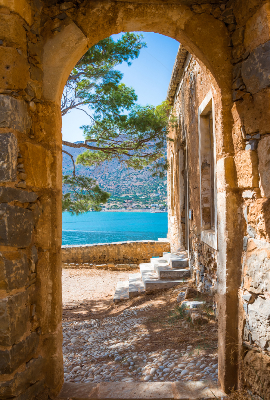
Spinalonga Island is a small island located in the mouth of the Elounda lagoon, on the north side of the Mirabello Bay. It has an area of almost 85 acres and the maximum altitude is 53 meters. The history of the island is still awe-inspiring - it has been a Venetian fortress, a castle-state, a refuge for rebels, a place of exile for lepers and a communication link with Cairo during the Arab occupation. The island was well fortified by the Venetians during their presence in Crete. Both from a construction and architectural point of view, as well as from the aesthetics of the entire landscape, the island still maintains its unsurpassed beauty. Its original name was Calydonia, but the Venetians called it Spinalonga from the Venetian word Spina-Longa, meaning long thorn. In 1903, the Cretan State gathered all the impoverished beggars living in settlements outside the big cities of Crete and banished them in Spinalonga.
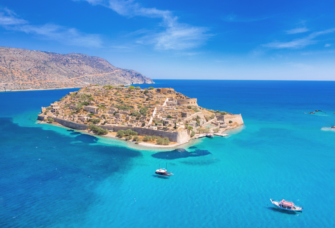
Thus, the island was turned into a leper colony for Cretan patients of Hansen's disease, known as leprosy. Initially, they brought lepers from Crete, and later from all over Greece. A story full of pain, screams and death would dominate the island for half a century. In the beginning, the life of the lepers was miserable. Spinalonga was an immense cesspool, a cemetery "under deadline", without the slightest organization, without medication for the sick, without hope. Later, the Leprosy Center was upgraded. It had a medical director, nursing staff, caretaker, cleaners, financial service and a priest. Large sections of the Venetian wall were destroyed in 1939, with dynamite in order to open the perimeter road which exists today on the island. On the occasion of the establishment of the leper home, the residents of Plaka across the street, built the current settlement of the same name, to serve the lepers who lived on the island. In 1957, with the discovery of antibiotics and the cure of leprosy, the leprosy center was closed and the island was deserted. With the growing interest of numerous tourists, systematic restoration and repair of the old buildings, the fortified Venetian walls, the old houses and the streets began in the 1970s while parts of the leper home were demolished. Today the fortress and castle town of Spinalonga are preserved, for the most part, in good condition and the island is considered one of the most important sea fortresses in the Mediterranean.
Over 300,000 visitors visit this beautiful island every year with boats departing from Agios Nikolaos, Elounda and Plaka, which is only 800 meters from the island. In recent years, efforts have been made by the local bodies to include Spinalonga in the monuments of the world cultural heritage of UNESCO. In 2005, Author Victoria Hislop wrote a sensational novel about Spinalonga called The Island, which won the UK Best Newcomer Award in 2007. The book spent 24 weeks in the UK top 10 and has been translated into more than15 languages, making Spinalonga and its story famous all over the world. The book was transferred to Greek television with the series "The Island" and was a huge success.
Plaka village
Plaka is located 16 km north of Agios Nikolaos and its trademark is the magnificent view of Kalydon island, where the famous fortress of Spinalonga is located. The existence of Plaka is strongly linked to Spinalonga, as from Plaka the first supplies, as well as the patients themselves, were transported to Spinalonga. So, the place was developed as a settlement to mainly serve the needs of the living "dead" of the island. Today in Plaka you will find picturesque fish taverns and wonderful traditional houses, which give you the impression that time has stopped here. Plaka could not be left out of the list of Crete's beaches, as it has two picturesque beaches with large pebbles and crystal-clear waters. The first beach, Agia Marina, is located directly in front of the large Blue Palace hotel, east of the settlement. To the west of the village is the second beach of Plaka with coarse pebbles, calm waters and tamarisk trees.
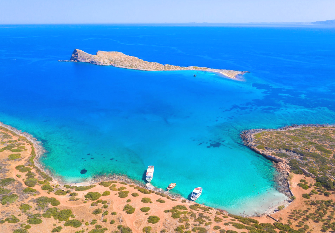
Kolokytha Beach
Kolokytha is a small island located opposite the Spinalonga peninsula, 12 km north of Agios Nikolaos and very close to Elounda. Between these two coasts there is a sheltered bay with the very beautiful sandy beach of Kolokytha. The beach with the clear blue waters is located below the modern church of Agios Loukas, from where a short path to the sea starts. The Byzantine church of Agios Phokas can be seen to the north from the beach, which was built in honor of the Byzantine emperor Nikephoros Phokas for the liberation of Crete in 961 AD. by the Arabs, which is worth walking along the coastal path. Access to Agios Loukas is via a dirt road that starts from the Salt Flats of Elounda with the windmills and passes through the Poros canal. Unfortunately, in recent years, the beach has been gathering too many people for its small size, as many tourist boats from Elounda have included it in their daily schedule, so it is best to avoid peak hours. (When you drive to Kolokytha island by car, make sure that you have parked your car at a tarmac parking lot and then walking on foot about 2km to Kolokytha beach).
Lasithi Plateau
Lasithi Plateau is located approximately 25 km south of Malia and 70 km southeast of the city of Heraklion. It is located in a calm and very fertile area surrounded by wild high mountains and several smaller plateaus. The Lasithi Plateau is the birthplace of the god Zeus. The altitude of the plain ranges from 800m to 850m, which makes it one of the few inhabited island areas in the Mediterranean at such a high altitude. Every winter the plateau is covered with snow and then thousands of Cretans find the opportunity to go out to admire the white landscape. Some years the snow remains on the mountain tops until the beginning of summer. The 18 picturesque villages of the plateau are built at the foot of the surrounding mountains, leaving the plain free for cultivation. Above the village of Psychro on the Lasithi Plateau, at an altitude of 1025m., you can visit the imposing Cave of Jupiter. Below the Cave of Psychro there is a comfortable parking area with several restaurants, from which two uphill paths start and the ascent takes about 15 minutes (the easiest path is the newer one, on the left as you climb up). On the way to the cave, the view towards the Lasithi plain is panoramic. The cave, which has an area of 2200 m2, is artificially lit and the route inside is 250 m long.
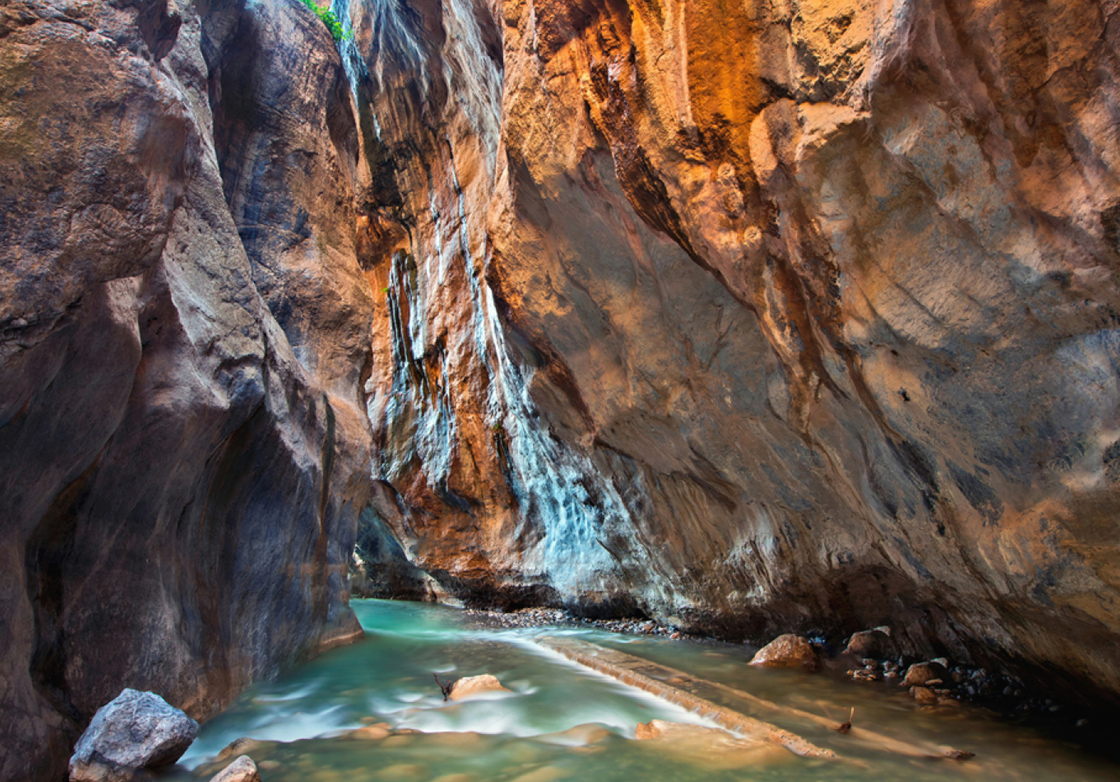
Sarakina Gorge
Sarakina is located a few meters outside and north of Mythoi village in the province of Ierapetra and a breath away from Myrtos village, where the mouth of Kryopotamos river flows through the gorge. The name of the gorge comes from the Saracens and is a toponym found in many places in Crete. It is considered by many to be the most beautiful walking gorge in Crete and they are probably not wrong. The length of the canyon is only one and a half kilometers but in this short route the visitor will encounter an incredible miracle of Cretan nature, a sculpture created by the water over the millions of years that erodes the rock as it passes. Sarakina has impressive walls that are found mainly in technical canyons, that is, canyons that have steep descents in their bed and their crossing is only possible with the use of special equipment. The impressive thing in Sarakina is the large amount of water that flows almost all year round, creating waterfalls of unique beauty and many ponds for swimming even during the summer. In the winter, the amount of water is so great that it is almost impossible to cross the gorge without getting wet. The Sarakina walk takes only one hour and from the beginning to the exit there is a path that passes under rocks that form natural bridges and narrow places. In all the difficult rocks, steps have been carved that help a lot in accessing and safely crossing the canyon, while at the most difficult point where there is a steep descent, a large tree trunk has been placed to bypass it.
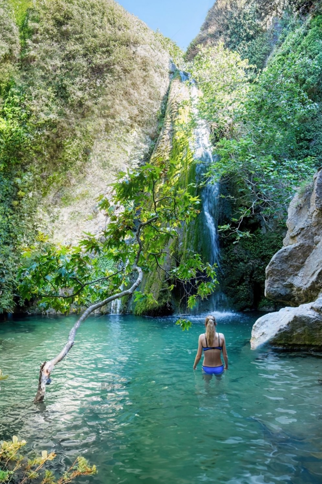
Richtis Gorge
Richtis Gorge is located on the northern side of Lasithi Prefecture, between Agios Nikolaos and Sitia. The path that crosses it starts northeast from the village of Exo Mouliana. The total length of the route is approximately 3 kilometers and the height difference between its entry and its exit is approximately 350 meters. The gorge can be crossed in three to four hours on foot, depending on the pace. The route starts from the stone arched bridge of Lachanas and it continues in a verdant landscape in the river, which is an oasis of coolness in Eastern Crete. But the highlight of all is the beautiful waterfall of Richti, 20m high, which forms a wonderful pond at its base and gives its name to the entire gorge. The word richtis means "waterfall" in the Cretan idiom and is found in many toponyms of Crete, both original and its corruption (riktis, rehtra, rehtara, richtra, etc.). The waterfall has water even in summer and one can enjoy bathing in its pond.
Extra tip: Usually visitors leave the car on the main road in Exo Mouliana. You can gain up to half an hour of walking if you go down from there and park at the Lachanas bridge. From there the journey to the waterfall takes about 1.30-2 hours. If you still want even less time, you can drive the narrow concrete road to the beach of Richti and from there walk about half an hour up the river to the waterfall.